JAMES BAY TARGET-RICH EXPLORATION

PONCHEVILLE

Target-Rich, Early-Stage Exploration Property in James Bay

Poncheville combines mapped pegmatite context, lake-sediment anomalies, regional structures, and target-ranking work to define multiple exploration priorities in the James Bay region.

PROPERTY SNAPSHOT

184 active claims

10,018.70 hectares (as of June 30, 2026)

Early-stage exploration

Target identification and field validation focus

More than 100 mapped pegmatite dykes

Mapped by the Quebec Geological Survey around Poncheville Lake

Regional structures

Interpreted corridors and cross-structures

Target-ranking work

AI-assisted process to prioritize exploration areas

LAND POSITION

184 claims · 10,018.70 ha

MAPPED PEGMATITES

>100 dykes mapped by the Quebec GS

PONCHEVILLE LAKE

Lake-sediment anomalies support prospectivity

TARGET RANKING

AI-assisted ranking to focus field programs

INDICATOR ELEMENTS

Selected samples with elevated indicators

JAMES BAY FOCUS

Nottaway is our current technical focus

WHY PONCHEVILLE MATTERS

Mapped Pegmatite Context

More than 100 pegmatite dykes mapped by the Quebec Geological Survey around Poncheville Lake provide a strong geological foundation for lithium exploration.

Target-Rich Setting

Lake-sediment anomalies, interpreted regional structures and cross-structures define multiple high-priority exploration targets.

Field Validation Opportunity

Limited historical field work and systematic validation present a compelling opportunity to test targets and refine the geological model.

PONCHEVILLE TARGET

A key part of CDN Maverick’s James Bay land package.

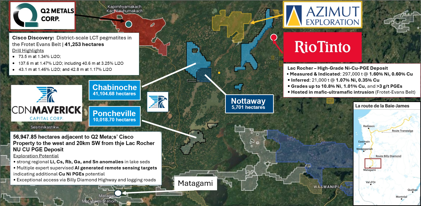
Located in the eastern James Bay region, approximately 60 km north of the Nottaway project and 30–40 km west of the La Grande all-season road, the Poncheville block comprises 184 claims covering approximately 10,018.70 hectares around Poncheville Lake. The Quebec Geological Survey has mapped more than 100 pegmatite dykes in outcrop across the area, while lake-sediment sampling has returned some of the highest lithium values recorded in the province, accompanied by similarly elevated cesium and rubidium concentrations—key geochemical indicators of prospective lithium-cesium-tantalum pegmatite systems.

Poncheville is an eastern James Bay target-generation property, shown with Poncheville Lake, regional access, and its relationship to Nottaway.

WHAT WE’VE LEARNED TO DATE

Lake-Sediment Anomalies

• Multi-element lake-sediment anomalies highlight prospective corridors.

• Provides a strong basis for target generation and ranking.

Mapped Pegmatites

• >100 pegmatite dykes mapped by the Quebec Geological Survey around Poncheville Lake.

• Confirms a fertile pegmatite system in the district.

Regional Structures

• Interpreted structures and cross-structures coincide with geochemical and pegmatite trends.

• Supports structural controls on pegmatite emplacement.

EXPLORE RELATED JAMES BAY PROPERTIES

CURRENT TECHNICAL FOCUS

Nottaway

District-scale platform with active exploration and field work programs.

DISTRICT PLATFORM

Chabinoche

Large-scale western James Bay position with strong exploration potential.